Monday, January 31, 2022

Mesa in the Mix

Mesa, AZ  High: 60's to low 70's  Low: mid 30's-40's. Site: 2608

Viewpoint RV and Golf Resort

AT&T hot spot on iPhones--SLOW   T-Mobile Mi-fi-not bad


Well-l-l-l...after enduring VERY cold temperatures in Cottonwood at night most nights, we headed to Mesa, a distance of two hours south, for some warmer weather. We will be here for one week. We are trying to figure out a way to change our itinerary from heading back to Cottonwood after this week and going to Yuma instead, but so far, our membership parks are full in Yuma. it looks like we will be returning to Cottonwood maybe.
 

Along the drive today, we saw some more beautiful concrete work and overpasses that reminded us of the beautiful drive when we went to Tucson. It made the short drive today very enjoyable. 

Even the sides of the road leading up to the bridges and overpasses had beautiful stone work inlay designs....arrowheads, Native American symbols, etc. laid out in stone arrangements of different colors. None of Sparky's iPhone drive by photos turned out on the stone designs, darn it! Here's one bad one, but it gives you an idea.


Arizona certainly knows how to make their infrastructure reflect their art and culture! Every bridge, every overpass on our route today reflected beautiful southwestern motifs and/or Native American symbols. Sparky loved the lizards under the bridge. (see at right)
Even retaining/sound walls that are usually pretty ugly, were beautiful.

We are at the Viewpoint RV and Golf Resort. Because it's part of our membership Thousand Trails  sisterhood of parks system, we stay here for 20.00 a day with full hookups. It has an 18 hole championship golf course, 10 tennis courts, 9 pickle ball courts, softball field, golf pro shop, 4 swimming pools, 7 spas, on-site restaurant, over 100 clubs and classes, on-site beauty salon, 2 fitness centers, a massage therapist reflexology person, library, laundry, woodshop, deluxe shuffleboard courts (beautiful, but not Sparky's thing) and probably more, haha. 

Nice to experience the full enchilada sometimes as opposed to being out in the woods or the boonies as we often are. We like civilized "glamping", too!

Sites are roomy enough in the park, but some are tight to back a fifth wheel into, and we had to make a sharp turn to get into our site because park model homes are directly in front of us across the street. You could get a 45 footer RV into the park sites, but you'd be right out to the road's edge. Here is our site:

We are on a back wall, but we don't mind that at all. There is a suburban neighborhood directly behind us. We have a really nice concrete patio, quite large, but the drawback is the location of the sewer. It's under the rig, that is the case for a lot of the sites, the hookups are not necessarily the most convenient. Sparky had to crawl under the rig to hook up the sewer hose! We have our own trash can and recycling bin. It does feel like a neighborhood!

There are a LOT of park models here, (tiny or small homes on leased land--usually--, for people who are snowbirds or live here seasonally. The newer park models are beautiful and have spacious patios.

We will certainly enjoy our stay here, and Sparky has found some good hikes for later this week--NOTHING like the mountain hikes in Sedona, but good ones all the same. We'll see you on the trail, or on the road somewhere. Bye for now!

Sunday, January 30, 2022

Our Last Couple of Days in Cottonwood, AZ and the RV Park

Cottonwood, AZ   Thousand Trails Verde Valley RV Park. High: 60's, Low: anywhere from high twenties to low forties at night. Site: G10

T-Mobile mifi signal: terrible  AT&T iPhone hot spot: not bad, but slow

Forgot to mention our RV park in detail! Thousand Trails Verde Valley is in the city of Cottonwood, AZ. Nestled in the mountains around Cottonwood and 25 miles from downtown Sedona, famous for beautiful red rock formations. There are 340 sites here. 

The park is a series of tiered levels...you drive in and down a steep hill going past different sections. The coveted section is at the top with the most incredible view--"M" section. Levels M, K, I, and J are the best for view. The main road is very good here, no potholes like so many Thousand Trails parks!

The view from the highest level

Our membership lets us stay here for free, BUT you have to pay 10 dollars a day extra for electric in the higher leveled sections. Mid sections are 5.00 a day extra for electric. As you proceed down the hills into the valley, you encounter many more sections, a total of nine, and the further down you go, the more crowded the sections become and the sites spaced closer together. At the bottom of the valley in the closer sites, you do NOT have to pay for electric. There are 62 new sites with full hookups. We are in "G" section, one of the newer sections--we get to look at gray, sandy rocky hills and pay 5.00 extra for electric in this section. BUT--the sites in this section are HUGE and spacious. 

mid section
There is a pool here, it was not open, but the hot tub was. There's a nice basketball court, shuffleboard, mini golf, horseshoe pits, a game room, a nice large meeting hall, two lodges and propane service. The propane service is run very efficiently. They actually have a staging area, and Mondays thru Fridays, from 11:30-12:00, you pull into the propane parking lot and get in line. The price was VERY reasonable--2.99 a gallon. We paid 4.00 a gallon in Elkhart! There was never much of a wait at all while we were here. They accept packages here for a fee of 2.00, so we had our mail forwarded here to get caught up. The Verde River runs along the east side of the park. According to the park map, there is an RC (remote control) run here, if that's your thing. By the way, there is NO laundromat.

hiking trail IN the park

What we love about this park is it is fairly close to Sedona and amazing hiking trails. There are even narrow hiking trails here in the park. They are very uneven, narrow and rocky. It's mountain hiking! Or hill hiking. Wear good hiking shoes, as the rocks slide around. Sparky got a great workout walking from our site (G section) to the top of the hill where the office is located, back down to our site every day, about a mile hike, remembering you are at 3240 feet in elevation. Take meandering trails around the hill to get to the top and you can get more exercise in. Regular biking trails are not in evidence, but there are plenty of mountain biking and hiking trails close to the park and further out in Sedona. 

walking around the three lagoons, beautiful!
Sparky hiked Dead Horse Ranch State Park trails several times just for a different scenery change from the desert. Walk the three lagoons the park for level trails. Lots more trees, greenery, and water there. Lots of cool ducks at the lagoons--the ring necked duck, which does NOT have a ring around its neck, contrary to what you might think! But it does have the coolest looking bill! If you are interested in more trails closer to Sedona, Red Rocks State Park has some great ones and then the Sedona area itself has AMAZING hikes!

Ring necked duck-no ring!

As far as the RV park's location, the Red Rocks are to your north, Mingus Mountains to the west, and the Hackberry Mountains to the south. The famous ghost town of Jerome is close by, and there are several wineries.

There are some really great restaurants here in Cottonwood. We've mentioned Crema--a great breakfast place with heavy southwestern influence on the menu, but pricey, The Belfry Brewery, also mentioned before, (Sparky is all about the local eateries, explains E.) The Red Rooster for breakfast, tasty but expensive, (big ole burrito--15.00!) and the Tavern Grill--terrific food--and that's our favorite! We did not try Sedona restaurants as the town has been super crowded with tourists, and the eateries are not socially distancing, from what we can tell.

Sparky went for one last hike...She tried to do Fay Canyon, a 2.6 mile heavily trackfficked trail-- on a Saturday. Forget that! Cars lined up for MILES on the roads leading to that trail and several more in the vicinity. She turned back to come home, but then saw a few cars at a more obscure trailhead, so she stopped and talked to a couple of mountain bikers. They told her to take the trail they just came off of, as it is a shared trail for hikers and mountain bikers. It was called Canyon of Fools. Here's the start of the trail, through a dirt "canyon". 

The idea is that you'd be foolish to be in this area after heavy rains or storms. The trail evens out and the dirt sides go away and it starts to look like this:

The views were spectacular--as they always are in Sedona with beautiful skies and fair temperatures. The trail was up and down but only slight changes in elevation. There were more hikers on the trail than there were bikers, but you still had to listen for the whiz of the bikes coming down as it is a single track trail in most places. Sparky did about 3 miles and could have done more, but wanted to be sure to get back with plenty of daylight just in case she took a wrong turn somewhere. (That scenario has happened more than once that I know of, says E.) Trail is marked, but not as much as a regular hiking trail, and as long as you are paying attention to the well worn bike trail, you should be fine. This could easily be a five mile hike or more as you can take loops of the side trails--the Yucca, and the Mescal spurs.

Sparky was amazed at how mountain bikes could traverse VERY pointed big rocks right in the middle of the trail, and rocky step like portions in the single track. She would think you could puncture a tire easily, even with special tires. Maybe they have the Kevlar inner protection safeguards, as she has read about. It sure as heck would be a jarring ride! But it looked like fun.
Canyon of Fools trail

And that about sums up our two weeks here in Sedona. We were planning on returning to Sedona after a week in Mesa, but because the temperatures are so cold at night here-- consistently, freezing or lower--- we think we might be headed to Yuma after Mesa instead. And--Sparky would be able to see her youngest brother, Charlie, if we do! Eldo is tired of being in the cold! We shall see...Stay tuned and you will find out where we went. We are going to miss this area despite the cold. So many more hikes to be done. Check out Trip Advisor's top ten hikes in Sedona, if you are interested. We hope to be back here next year in March, when temps won't be quite so frigid at night.


Thursday, January 27, 2022

And Everything Comes to a Halt for the Moment

Back in late summer of last year, we had a suspension bracket break behind our wheels of our fifth wheel. It could have been disastrous, but we were lucky. We were able to get it repaired, before the tires had gotten too close to each other, possibly rubbing enough friction to start a fire or explode a tire. We found an excellent body shop guy in Ashtabula, OH, who welded and repaired the broken bracket with a new plate. We had been watching the other side for a possible problem and here it comes. This was the crack (photo on the left) when we got the tires off and replaced in Tucson. We were ready to leave the next day so thought we could make it ok to Cottonwood. We did. BUT--this is the crack as we arrived in Cottonwood. We had some bad sections of I-10 but not sure if that made the existing crack much worse. Much worse than we thought.

We are NOT going to drive the rig in this condition. We could limp to an auto body shop like we did before if we can find one in town. But, as we are here for 11 days, we are going to try and find a mobile tech who can come and make the repair on site. After calling around, we found one! We HIGHLY recommend Verde Valley Auto Electric, and specifically, Jack Crow. He moved his schedule around, so he could get to us before we were scheduled to leave Jan. 31st. He was professional, kind, and knowledgable about all things RV. The only things he said he doesn't work on, are black tank issues. Can't blame him there. The price of the repair was very reasonable and he did some major welding and reinforcing so the bracket should hold for a long time to come. The one thing we learned and didn't realize that those suspension brackets don't always break because of driving on bad roads (as Lippert, the manufacturer tried to tell us) but that if you make severe cornering turns while maneuvering your RV into tight places and difficult sites, you are stressing the suspension bracket to the max. He said that you can tell that's happening when the tires appear to flex abnormally so like when the fifth wheel is at a right angle to the truck. Sparky had noticed this a time or two, but didn't realize it was not a good thing. Sometimes you are forced into backing into very tight spaces with very little room to maneuver, like no room in front of you to pull forward and back.

In the meantime, as it is the weekend, we are exploring the area. We took a drive into Sedona, just to see how much it's changed in the 10 years since we've been there. It's gotten more developed, as expected, the crowds seem bigger despite Covid, but the scenery remains as spectacular as ever.  We are about 25 miles from Sedona from our RV park. 
We attempted to visit the Chapel of the Holy 
Cross, built into the side of the mountain in Sedona, but the parking areas are very restrictive and tiny-- it was impossible to get in on an early afternoon the day we tried. It's a must see, if you can time it right.

Sparky has visited Dead Horse Ranch State Park three times. It's 7.00 each time to get in, or you can buy an annual pass for 75.00 plus a 7.00  handling fee. We just couldn't decide when to buy it and when we would be back to AZ to use it to pay the yearly amount so for now, we will see how much more we want to visit the state parks. Dead Horse Ranch State Park is beautiful and big, 423 acres. There are 10 miles of hiking trails, 150 campground sites, some big rig friendly, and beautiful changes of habitat as you make your way through the park.

There are three lagoons that you can get an easy hike in of about 2 miles or more by going all the way around them twice. There are ring neck ducks in the pond, and the scenery is beautiful. That's one thing we have noticed about this area. Cloudless skies are common and the day time temps, although cool in the fifties, are very warm in the sun.

There is a birding area at Dead Horse Ranch. They put out some feeders and thistle seed socks. That usually attracts a lot of birds! The first time Sparky went, there were birds galore....house finches, goldfinches and more. How about a bridled titmouse? Sparky loves learning more bird species and plant species in Arizona.
Bridled Titmouse

The other two times, there were no birds. Phooey! Must have been the time of day, which was midday the second and third visit. Best to go early morning or late afternoon. Nice walking trails in the park, no elevation or climbing....You are traveling through very old cottonwood and aspen forests in the birding section area which is off Owl Road. 

There are other trails available that connect to other parts of Cottonwood, such as the 15 mile old wagon road Lime Kiln Trail, which connects Dead Horse Ranch to Red Rock State Park, and is a shared use trail, but Sparky wants to do more serious hiking and climbing in Sedona after doing a terrific hike recently. (See last blog post, about Devil's Bridge.) It's going to be hard to top that one! 

Sparky also visited the Tuzigoot National Monument nearby in Cottonwood. Don't you just LOVE that name? It's Apache for "crooked water". Sparky went to visit it just because of the name. It's a national park service site, so be smart and have your senior pass with you so you don't have to pay 10.00 to visit. (I'm always telling her TAKE YOUR PARK PASS WITH YOU! says an exasperated Eldo.) This monument is dedicated to preserving the history of the Southern Sinagua, who lived in Verde Valley thousands of years ago and flourished. 

Bird's eye view of the remains
The Sinagua lived by farming, hunting, and gathering. When they lived in the area, water was plentiful and the land was fertile. Their pueblo dwellings were huge and made from cobblestones. The original village was two stories high, and had 87 ground floor rooms! There were few exterior doors, they used ladders through roof openings. It's hard to imagine the original structures from cobblestone ruins, but the park service does a great job with signage and information about these Arizona peoples. Both this site and Montezuma's castle (which your entry fee ALSO covers) are worth visiting to learn more about the Sinagua. Montezuma's Castle is 33 miles from Tuzigoot Monument. It is also a Sinagua dwelling, in a cliff recess 100 feet above the valley. Both sites have a nice, short hard surface walking trails with signage to learn more about the area and the people who originated here.

We are headed out in a couple of days for Mesa, Arizona. We will be there a short while, and then back we come to Verde Valley. There is so much more to see and do here!  We hope you are enjoying and learning along with us, we so appreciate those who stop to read and see what we are up to!  See you later down the road.....

Wednesday, January 26, 2022

A Hike I Will Never Forget

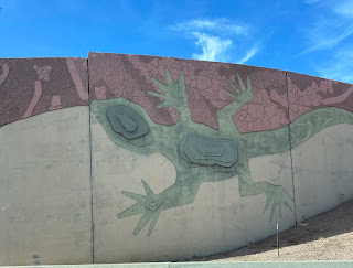
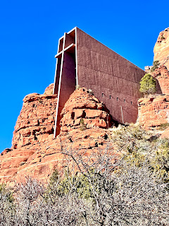
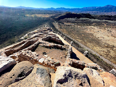
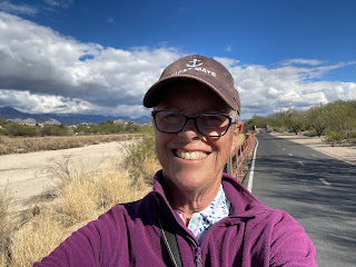
 Sparky is going to divert from her usual third person narrative and tell you about an amazing hike in her own words. It was one of those moments that is life changing and heart felt so here it is....

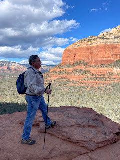
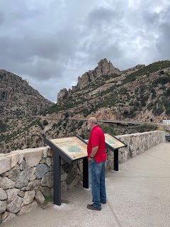
This year I turn 72. I've been fighting my age since I hit 65. The mind says I feel about 25 years younger, the body says differently. I've had bad sciatica for some time, but just keep pushing myself to keep moving. I am beginning to realize my physical limitations but I'm not ready to call it quits for hiking and other adventures! I saw this hike which seemed not too difficult. "Devil's Bridge is a moderately difficult, 1.8 mile roundtrip journey that takes you to and from a 50 foot high arch. At a height of 4,600 feet at the trailhead, the Devil's Bridge trails is a roughly 500 foot climb with an aesthetic that should leave you breathless." That sounded very doable to me, so Eldy, as thoughtful and generous as he always is, not being able to hike because of bad knees, offered to drop me off and pick me up later.   I wore my Merrill hiking shoes and took one hiking pole with me.

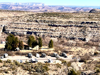
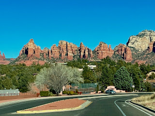
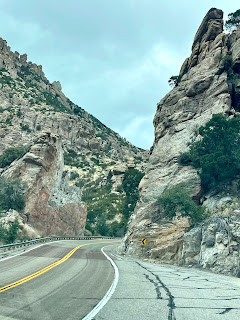
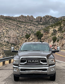
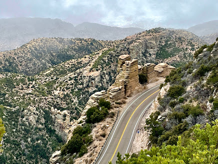
The drive to the trailhead
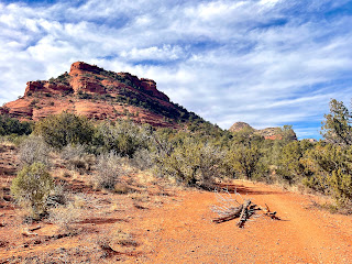
There were some precautions in other literature...the drive to the trailhead once you get to the location is for "high profile vehicles only." That means four wheel drive with good clearance underneath your truck. But as the parking lots were full, and it was a one lane drive into them, Eldy dropped me off at the bottom of the parking lots near the main road, and off I went. It was over a mile walk just to get to the trailhead. The lower parking lot (overflow) was full in the early afternoon, no surprise there. You walk the jeep road to get to a fork in the trail. Here is what the road to the trail looked like. I wouldn't have wanted to try that even with our Dodge Ram 350!
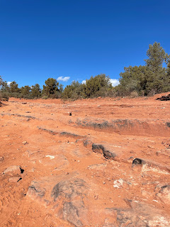
A bad entry road to the trail for ANY vehicle

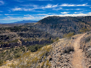
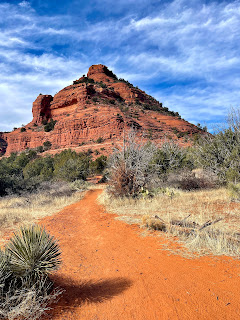
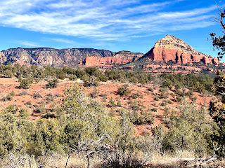
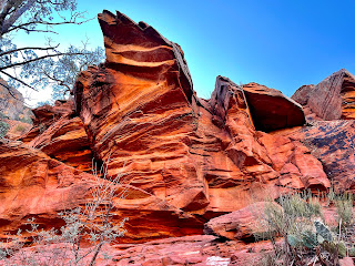
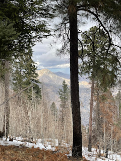
The path slowly takes you uphill and steeper. Three quarters of a mile from the parking lot, the trail divides. Go to the left and you will hike to the base of the bridge. Take the right and you climb to the top of the bridge. I took the right. The going wasn't bad at first, and the views off to the left were stunning.

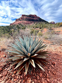
It really wasn't a bad climb in the beginning at all. I passed several older people coming back down and I asked them how the trail was. At least a half dozen said there was some rock scrambling involved and it was too much for them. I thought, well, I've scrambled across boulders and rocks before and climbed very steep trails, I wasn't too worried. The views continued to amaze.....

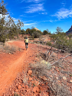
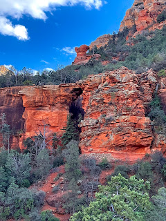
There were not a lot of people on the trail, but enough that I wasn't worried about hiking by myself. Not only that, but people with dogs were coming back down, so I felt reassured that it would be fine. Around every corner was something to take your breath away....Here the sun was hitting the sandstone rocks and they really were that orange!
It started getting rockier the closer I got to the bridge. 

And this is where two guardian angel hikers join my journey.....

I was starting to slow down just a little and apparently showing some hesitance. Russ and Anne Dick, from Peru, IN, were ahead of me. I was carefully watching them pick their way through the rocks and when the rocks REALLY became narrow and steep, Russ turns around and says something about hey, why don't you hike with us as we make our way to the top? And I thought you bet, as it was starting to get a little nerve wracking. I wish I had taken photos of how narrow the rocky steps were. The steps were not much wider than your two feet placed side by side with THOUSANDS of feet dropping off to one side, and the same on the other side. My focus had to be TOTALLY on watching where I placed each foot, and where I put my pole. I got to one point where I was going to stop and turn around and for me to admit, hey, this is going to be too much for you, you need to quit because this is VERY scary and precipitous, is saying a lot. My balance is TERRIBLE. One faulty step and I could have easily fallen off the cliff. Russ and Anne kept encouraging me, and since they were close to my age, (younger for sure) and they were going steadily up the cliff face, I thought, OK, I can do this, but what I didn't know was the hardest part was coming. There were more cool views to keep you motivated. Here is a tribute of sorts, to the trail....

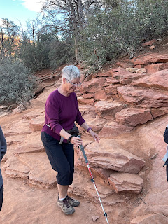
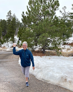
The last 300 yards is NOT a moderate hike for seniors. It is difficult. We just took our time and with my hiker guardian angels, we made it to the bridge. Here is where my second thought of stopping and just taking photos of everybody else crossing the bridge would be enough, I was NOT going to get on that bridge. I was going to be the official photographer and take everybody else's photos! And I would have been content with that. Ann and Russ traversed over to the bridge, came back and said, "Hey, the actual bridge is quite wide. You can do this!" And Anne offered to walk with me to the bridge and back. So we did. I got to the bridge, Anne graciously stepped back so a fellow hiker could take my photo so I could be alone on the bridge, and I raised my arms in excitement, and shouted out, "I DID IT!" Everybody on the other side, waiting to cross to the bridge and get their photo taken, cheered and clapped. 

The bridge may only be 50 feet tall, but the bridge is 4,600 feet up in the mountains. You just can't capture the scale and dimension of what you are seeing with a little phone camera, but you get the idea. After getting everybody else's photos, we started the equally challenging trek back down. Here is Russ....

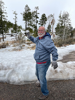
and Anne, taking his photo....

All the way we were together hiking, Russ would position himself between us or behind us, taking turns looking out for Anne and for me, offering little tips like how to carry your pole while clambering amongst the rocks, put your weakest foot forward first, follow up with your strongest. We talked about a LOT of different things, our careers, our travels, etc. and it really helped calm my nerves during the most difficult parts of the hike. Thank you so much, Russ and Anne Dick, for helping me achieve a hiking goal I almost didn't make. Here is a view of the bridge from heading back down....

This was a day I will never forget. I faced my fears with the help of kind companions and I worked through my fears with their help. It was kind of a life lesson for me, that if a community can look out for its members, care about its members, and support them, whether it be a a neighborhood, a 

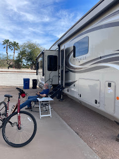
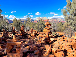
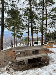
this took real planning!
school, an RV park, or a hiking community, it makes the world a better place. For me, it gave me hope and a little bit more confidence, that even at the age of 72, I can still try to achieve goals and dreams and that it's ok to keep trying, no matter what your age! Hey, if Grandma Gatewood at age 67 can hike the entire Appalachian Trail, and a lady in her eighties can bike across the United States (whom we met in our travels), I can still dream! Thank you to my Eldy, who never waivers in his support of my hiking and adventurously wanting to wander off in the wilderness.


Thursday, January 20, 2022

Sky Islands Scenic Drive and the Loop

We took another drive out to Mt. Lemmon today. It was a much cooler day in the valley, 61 degrees when we started. It got to 36 degrees at the top. It's about a 25 mile drive to the top of Mt. Lemmon, and it's a jaw dropping, breathtakingly beautiful drive all the way. Someone said it's like driving from Mexico to Canada, all in one hour or less drive. 

Fantastic scenery once again, even though it was very cloudy, with rain chance hovering around 45%. Is that SNOW????

Yessiree....at about 7,000 feet, you start seeing snow. Lots of it! Sparky gets so excited!
Hey, even Eldo decided to make a snowball. Sparky pelted him with one, and he threw one right back.

Wonderful picnic areas on the side of Mount Lemmon. You can see why this drive is called "Sky Islands". Perfect name for it!

Lots of overlooks and pullouts....

WOWZA! What views!
A view through the trees...
The trails look really rugged and tough....but Sparky will just have to check it out the next time we come back in a few weeks....This one is called Soldier Trail and it was extremely rocky and uneven.
We checked out the ski area near the top of Mount Lemmon. It was closed, but the parking lot was so tiny, we wondered how the skiers could park there on open days.
For the last day of our stay in Tucson, Sparky headed out on the Loop Trail one more time, heading out from Udall Park once again. It is officially known as the Chuck Huckleberry Loop, and is the #1 trail in the US for recreational trails on USA Today's list. Sparky headed east towards a new section of the loop and viewed some more cool art installations. Beautiful iron arch window...
Riverside parks stops to rest and relax...except there is no river currently flowing...
Arroyo Del Fuerte

Here is a bridge over an arroyo--a steep sided gully formed by fast flowing water that seasonally fills and flows after heavy rains...found mainly in the southwest. A wash is very similar, it's a dry bed of a stream that fills and flows only occasionally or seldom. It's usually in a ravine or canyon. They pretty much mean the same and so are now used interchangeably. 

Another view of the bridges Sparky saw on her last bike ride. 
Always, the mountains are within range....(HAHAHAHA...)

How would you like to bike this every day? Sparky would! Well, almost every day if the old body would permit it.


One of the cool sections on The Loop is a series of memory gardens near Pantano River Park. There are SEVEN specialty gardens--Each is a series of commemorative trees with a special motif or theme to mark the passing of someone special, to celebrate life or a special occasion. The gardens are: The Garden of the Children, Garden of the Families, Garden of the Masks, Garden of the Flute Players, (Sparky's mom loved Kokopelli--the flute player) Garden of the Winter Solstice, Garden of the Summer Solstice, and Garden of the Sun. Some of the commemorative trees have painted rocks or expressions of loss, hopes and dreams in unique forms at the site. Sparky saw a couple of glass bottles with messages inside at one site. You can really get a feel for the person's life and what they were like by studying the site. At the start of each garden area is a big panel with the numbers of the sites and the person's name represented. What a wonderful way to remember someone!

What a ride on the loop today! About 21 miles this time....Sparky went looking for a website that tells you all about the art installations' locations along the trail and here it is...https://www.webcms.pima.gov/UserFiles/Servers/Server_6/File/Government/The%20Loop/Loop%20Art%20Map/7705%20update%20loop%20art%20map%20web.pdf

And off we go to our next destination....Cottonwood, AZ, about 35 min. from Sedona. We will be exploring the area a LOT, hopefully. We are staying at the Thousand Trails Verde Valley in Cottonwood for 11 days.....The vistas are amazing! Stay tuned for more about the park and our explorations....See you down the road!