Traveling Day.... Tucson to Las Cruces NM via I-10, overnight stop at Sunny Acres RV Park,
site 48 Highs: 70's to low 80's, lows: 40's
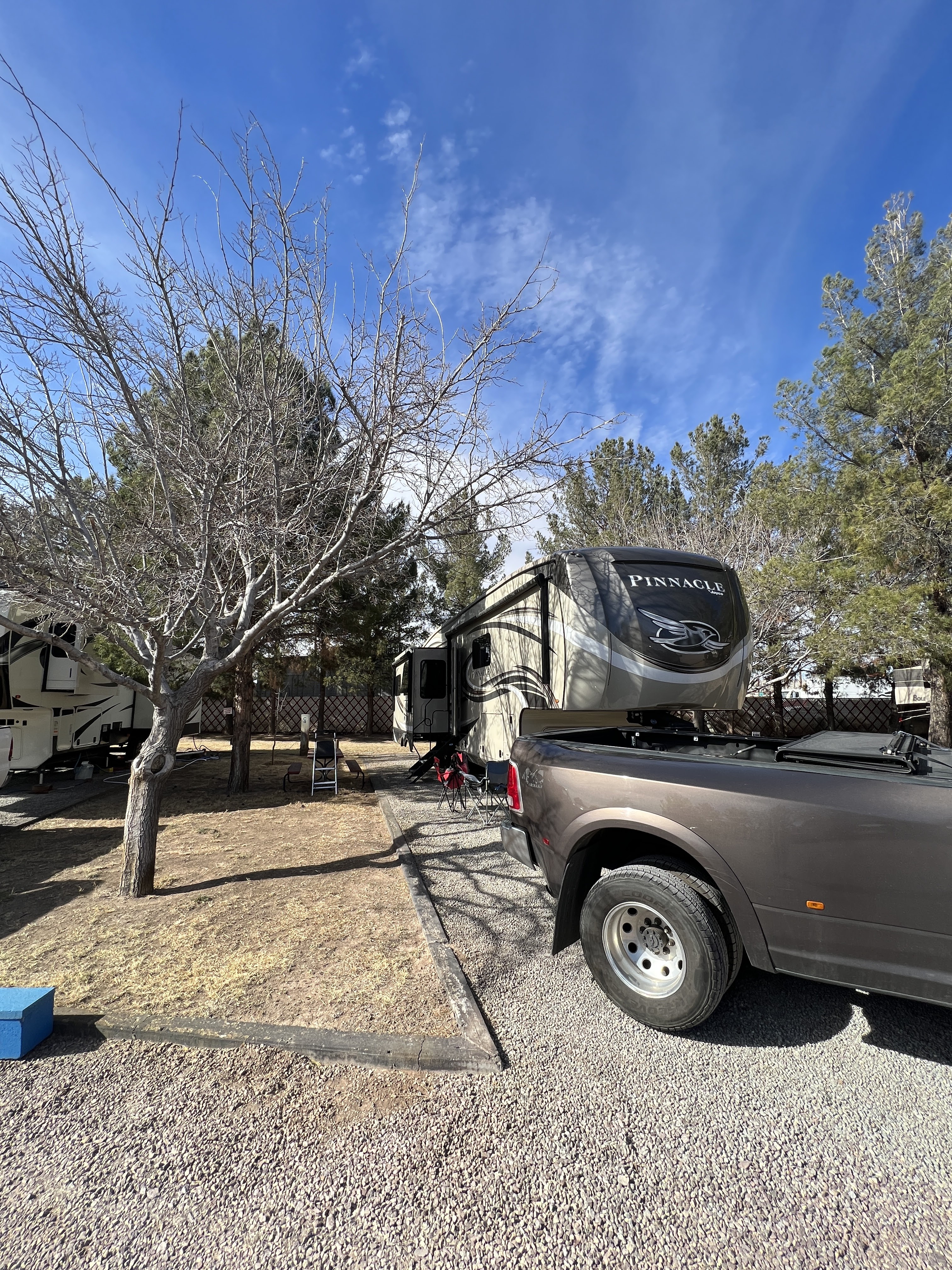
We had a good hitch up Monday morning. A good hitch up is when all the slides come in ok, the jacks come up as they are supposed to, and Sparky gets the hitch on the RV to the right height to match the connector in the truck, and the truck backs right into the hitch with a resounding "CLANK" which means it connected soundly. Our goal was about 265 miles of driving which sent us along I-10 to Las Cruces. I-10 was TERRIBLE as far as quality of pavement. We really shook, rattled and rolled as we went along until we got out of Arizona.
Luckily, we called a couple of parks ahead of time before finding one that could take us. Normally, there are a lot of parks to choose from on our way, but because of bad weather conditions in California and in the northern areas of Arizona, RV traffic has dropped further south, and people are on the move in early March anyway to get towards their summer destinations. Snowbirds are thinking about heading north back home wherever that may be. So a couple of parks said, "Sorry--we're totally booked and we are busier than normal."
 |
Sunny Acres had PLENTY of room to maneuver, and plenty of room between their back in sites towards the back of the park. It's a small park, about 78 sites but very lovely. There are pull thrus, but not very many. There were a lot of seasonal people staying there. There are TREES, which means there is SHADE, and birds--LOTS of mourning doves or white winged doves and other nice things--a porch with rockers at the laundry/shower house, for one. You also get a picnic table that might be covered in bird poop, haha. Don't say you weren't warned about all the doves!

They even had a nice pickle ball court!

 |
| site 48 |
We were only here for one night, but we would have loved to have stayed longer, it was more like staying in a real campground instead of the usual stone/gravel, concrete pad snowbird parking lot. Even though there were beautiful amenities galore at the last park, the Voyager in Tucson, the standard sites were very narrow, and we never enjoyed staying outside our rig at our site much while we were there. No view except for your neighbor's rig or truck.This place is different. It's also great to be near a large city, Las Cruces has a population of over 112,000, so plenty of things to see and do there. BUT--we will have to wait for a longer stay to explore Las Cruces on our next trip back out west for the winter.


We were off the next morning for Davis Mountains State Park in Fort Davis, TX. The GPS route out of Las Cruces, NM had us take I-10 to TX 90 South. Shortly after getting on TX 90, our GPS warned us that 4.5 hours had been added to our trip! We had no idea how such a delay could occur...train derailment? Road blocked due to rock slide? Fatal accident? We turned around and headed back to I-10 East. The GPS had us take route 118 into the Davis Mountains and into the state park. Big mistake! That was 50+ miles of curvy, winding, steep, two lane highway and a white knuckle drive for Eldy. Davis Mountain State Park is up in elevation at about 5,200 feet, so we were climbing most of the way. Eldo was watching his engine temps all the way besides watching for oncoming cars. You can see the many switchbacks on the map below. We didn't know. We were just following the GPS! The better route--(the MUCH better route to coming into the state park from the north would have been to exit at Balmorhea and head south down highway 17).

This will be our first state park in Texas. State parks can be problematic for RVs over 40 feet. Some states really know how to be ready for today's larger RVs and with Texas, everything is bigger, right? Davis Mountains State Park is big rig friendly. They have FULL hookups, 50 amp electric and sites can be up to 60 feet long, but they do have a curve to them. The sites are also not level. You are in a mountainous valley, after all. Some people had a dickens of a time trying to get their rigs level. this is a big NO-NO, to have any of your tires off the ground and no support under them. Yikes!

 |
| site 24 |
We got fairly lucky with leveling our rig, and Eldo was able to get our rig on somewhat of an even keel. It took us awhile to do it, however. At each pull thru site, there is a covered ramada for shade and a nice metal picnic table. There's lots to tell about Davis Mountain State Park and the nearby area, so Sparky will save that for her next post. See you in the park and on the trails!
No comments:
Post a Comment