Showing posts with label Baxter State Park. Show all posts

Friday, August 24, 2012

The Quest for Moose is Abandoned!

Abbott, Maine    High: 79  Low: 59

We went for the third day, hunting for moose....This time we decided to get deep into the heart of Baxter State Park. The local literature says, "If you haven't had your fill of moose by the time you get to  Lily Bay State Park, (just north of Greenville) head over to Kokadjo and try Lazy Tom's bog...." Etc., etc., etc. We tried those tried and true moose view sites to no avail. It's time for more serious, in depth moose hunting strategies! We're game...heh, heh, heh....

We decided to go further, all the way to Baxter State Park. People talk about spotting moose in and around Baxter a lot. It's an hour and a half drive from Abbot at Balsam Woods Campground, where we are staying, to Baxter State Park. We took highway 6/15 to highway 11 north to Millinocket, and continued to 159 north into the state park. The roads are not the best, but they are a LOT better than coming into Baxter on the west side. Speed limits of often lower than 55, slow the trip way down, but that's ok, we're retired, we like scenic drives.

On the way, we saw some beautiful scenery....stopped at a little roadside park for lunch with one picnic table and a beautiful view of Maine's mountains in the distance.
We drove on....We saw this little bridge out of the corner of our eye and stopped...It was a narrow suspension bridge, built especially for snowmobilers so they wouldn't have to cross on the regular highway roads over this particular river.
And on we drove....

We spot this really cool rock, with Mount Katahdin, the highest mountain in Maine at 5,268 feet, in the distance. It was painted on both sides, with more painted boulders behind it. Very cool!
And on we drove, we're getting closer! We finally reach Baxter State Park, and here is the first thing we saw......And no, it was NOT a moose! This is a warning sign about the road that goes through the park. It's narrow, barely enough room for two vehicles passing each other, and it's NOT paved. They say it's graded regularly during the summer, but heavy rains can wash out the road at any time.
Here are a few things you need to know about Baxter State Park, which we did NOT find out from the ranger entry station after paying 14.00 non-resident fee to get into the park. You know how parks usually have a Park Loop Road, or the main road that traverses through the park with pull outs and vistas and scenic views? Guess that's maine-ly national parks. Because this one has almost zero pullouts, trails are poorly marked, and to add insult to injury, the governor of Maine who bequeathed the land for this state park specified the roads were NEVER to be paved, that it was to stay WILD forever!

Two vehicles can barely pass each other on the narrow, gravel road, there are MANY blind curves, people do NOT follow the 20 mph speed limit, and heaven forbid you should come across a grader (we did) which takes up 3/4 of the road! There is no place to safely pull out to see the many ponds in most cases, the few parking lots we encountered were spaces for three, maybe four cars, and you have to hike in to see the ponds or views for the most part.

This is a HIKER'S destination...people come to hike Mount Katahdin, which is spectacular, and to hike the trails that connect to the Appalachian Trail which starts or stops at Mount Katahdin depending on which direction you are going. The park has lots of rules. No vehicles over 9 feet high, 7 feet wide, or 22 feet long are allowed. There are no flush toilets, there is no electricity or RV hookups. Cell phones are unreliable. No pets. Motocycles are prohibited. No shower facilities. No convenience stores. No gas stations. No water spigots. You carry everything in and carry everything out, including personal hygiene items. No trash receptacles.  OK, got it. Wish we had read about this park ahead of time. Wish the park attendant had told us it was a 12 mile drive back to the pond where moose can be seen on occasion if we HAD gotten a moose pass. More about that later.

When we checked into the ranger station and paid our fee, we asked about moose. They give out MOOSE PASSES, good for three hours at a time to watch at the Sandy Stream Pond. They didn't have any available, but the ranger told us a couple other ponds to try. Maybe later, she'd have some, she said. So we traveled deep into the park on another road. The road never opened up, what ponds we could see, we were barely able to get off the road onto a narrow side patch of gravel to get out and look for moose. There are no paths down to the ponds except for one or two that we saw.

We kept driving....
And driving and stopping.....

And driving some more.....
No moose...It was getting late in the day.. We stopped back at the ranger station. Still no moose passes available to go to the Sandy Stream Pond. She let us go back anyway. Twelve miles later, we dead ended in a parking lot. No pond. Lots of tenters and hikers. We asked where the pond was. It was a hike of about 3/4 of a mile back into the buggy woods. Nope. Not going to do that. Sparky was already bitten in a bunch of places. Not worth it. There was one more place to revisit while there was a half hour of daylight left. We decided to go back to a really boggy marsh as the sun was setting. It was near the beautiful Abol River Campground. Sparky got some photos of a fly fisherman at the Abol River Bridge......
and the fantastic view at the bridge....
and a log truck barreling down on the bridge....

You gotta watch out for these log trucks, they own the roads up here. Seriously, they do. Many of the roads up here are privately owned by the logging companies, and they are in terrible shape from all the heavy duty truck hauling..They don't always stay on their side of the road, either! (Ask us how we know!)

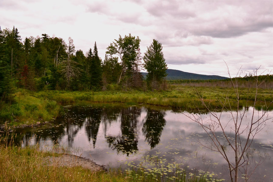
The last bog we visited....It looks like the perfect place for moose to dine, too!


No moose....Time to go home, kids!

We tried....We looked high and low today.

We thought about getting up at 4:00 AM (Sparky, only for about two minutes) to try the early morning time since all our efforts have been at dusk, but we figured we probably wouldn't see any then, either! So, with a little bit of disappointment in our hearts, but some great photos of some of nature's bountiful beauty, we headed home for the night.....


Thursday, August 9, 2012

Here, Moosey, Moosey! Some Moose Watching Tips

Bar Harbor, ME    High: 78   Low: 58

Does this mean we saw a moose? Not yet, but we sure know where to look after driving about 11 hours yesterday on the back roads of Maine, some of which shouldn't even be considered roads! We were not sure after we leave here whether we will stay in Maine or head west, so Eldo suggested that we drive over to Greenville for the day, and scout out all the favorite moose sighting locations over there. Sparky said, SURE! And off we went with a picnic lunch on our very own moose hunting safari.

Since this is our second visit to Maine, the first one was two years ago and we DID see moose, we had a good idea of where to go looking again...in the Greenville area near the appropriately named Moosehead Lake. The area is FILLED with bogs, a moose's favorite place to hang out. Moose outnumber people 3 to 1 in the area, so you SHOULD be able to see a moose somewhere either at dawn or at dusk...and maybe in between. Of course, the population numbers of people in this region is not very high as it is a very rugged, swampy, mosquito infested area as well.

When you look at a map of Maine, you don't really see the hundreds of rivers, ponds and lakes that are in the highlands area. It's incredible how much water there is!

We spent hours and hours yesterday driving crazy dirt, stone and gravel lumber roads dodging lumber trucks looking for moose. The weather was cloudy and looked like rain. Do ya think we could find a moose? NOPE! Maybe they weren't out and about today because of that, but it never did rain. The roads we were on were AWFUL!  Here's the route we took, we DON'T recommend it, there are other directions/ways to get to Baxter State Park...(but don't ask Sparky, heh, heh, heh! says E.)

Out of Bangor, Maine, we took highway 6/15 to Greenville. We checked THE spot for seeing moose, but it was too early in the day---the D.O.T. location right off 15, on the west side of the road. We had word from the new visitor center nearby that a mother and her calf frequented the bog.  No moose.

From Greenville, 6/15 splits off to the left. We continued right on the road to the tiny town of Kokadjo. The sign into town says, "Town of Not Very Many." They are not kidding! Just a few buildings, a couple of houses, and a restaurant  compile the little town. Sparky stopped to get a photo of a boulder (little things amuse retirees, don'tcha know?) that she took two years ago. She just liked the setting. It wasn't as pretty a day today, but it still was peaceful.

On to the  Lily Bay State Park area and past it. The road turns into a ROUGH, potholed, gravelly lumber road populated with LOTS of lumber trucks barreling down these roads. GET OUT OF THE WAY OF THE LUMBER TRUCKS! They have the right of way, and they are MOVIN' down the roads, FAST! (Good way to get a chip in your windshield, but thank goodness, we didn't!) We did not go into Lily Bay, but continued on towards Baxter State Park, stopping at every little pullout, every little scenic view of bogs, marshes, and swampy areas looking for moose. Sparky saw a muddy bridge crossing, with---COULD IT BE!!?? MOOSE FOOTPRINTS!  There MUST be some moose nearby!  These looked fresh! ON WITH THE SEARCH!


It's a beautiful drive, although the roads are crappy...you are passing through the Penobscot River Corridor, and there are boondocking campgrounds along the way, (a big rig could get in, but who'd want to drive along these roads to get there unless you come from the OTHER direction) and some awesome rapids to see....about a class II in the areas we looked at.

Sparky experimented a little with her camera settings to try and get the flow of the water....Not bad...

It was getting late in the day...but still no moose sightings....We stopped at a small campground called Abol Bridge Campground...The views of the nearby mountains were breathtaking.

The campground was boondocking only, as are quite a few campgrounds in the area. Eldy talked to a gentleman who was asking about our Honda CR-V. The man had just had a fire in the CR-V while pulling it down the road, and the car was totaled along with damage to his rig. He said a blowout was the cause, but since he didn't have a tire pressure monitoring system, he didn't know it until it was too late. Insurance covered his loss, fortunately.

We enjoyed talking to him, he's been a full timer for eleven years!...He gave us another spot to check for moose about three miles down the road...It was the PERFECT, shallow bog, HUGE grassy area...But, NO MOOSE!  With that, on we went, we looked a little more and found another spot.....No moose, just a beautiful view...sigh!
Time to head home, Sparky! It looks like we are not going to see any today, but we'll go back again....We'll leave you with some moose facts and a few top locations to look for moose in the Maine Highlands area:

1. The flap of skin under the moose's throat is called a bell.
2. Moose have no top front teeth.
3.After the first calf, moose frequently have twins.
4. Only the males grow antlers, and they shed them in early winter and start growing them again.

Best times to see moose:
1. Early in the morning, and at dusk
2. Best time of the year is May and June.
3. Moose prefer shady, wet areas such as bogs and marshes.
4. Driving after dark is a common time to see them--be careful! The lady at the visitor center in Greenville said three moose had been killed on highway 15 this summer in the Greenville area.

Moose hangouts in the Highlands of Maine:
Note: Not being from the area, some of the places on the list might be the same names or spots repeated. These moose hunting locations are taken from more than one source of handouts the visitor center gave us and a couple of them seemed to be talking about slightly different areas.

1. the D.O.T. (Department of Transportation) heading north towards Greenville, as you drive thru Shirley, watch for it on the left, across the road--the Shirley Bog
2.Kokadjo--stay on Lily Bay Road for twenty miles, watch for moose
3. Lazy Tom Bog--continue 1.5 miles past the bridge in Kokadjo. Stay to your left, then take the intersection to the left and continue half a mile more to the bridge over Lazy Tom Stream.
4. Mount Kineo/Rockwood--Drive to the town of Rockwood, (north of Greenville), head to Mt. Kineo for hiking or exploring, watch for moose. Route 15 is Rockwood Road in this area (?)
5. 20 Mile Road
6. the Golden Road
7.  Sias (?) Hill Gate of the Golden Road
8. Lily Bay Road

And if you don't find any moose, hire an outfitter! There are more than 17 on the list we were given. We did that two years ago, went early, EARLY in the morning on a kayak adventure to see moose, and didn't see any! So no guarantees, folks, the fun is in the hunt. We really enjoyed ourselves today even if we didn't see any moose, and that's all that matters!  Bye for now.....